Big Bear Lake Top Paddling Spots
Big Bear Lake Offers 2 Locations to rent kayaks. Boulder Bay and Veterans Park.
Boulder Bay- 39166 Big Bear Blvd, Big Bear Lake, Ca 92315
Veterans Park- 40905 Big Bear Blvd, Ca 92315
Boulder Bay- 39166 Big Bear Blvd, Big Bear Lake, Ca 92315
Veterans Park- 40905 Big Bear Blvd, Ca 92315
#1 Boulder Bay
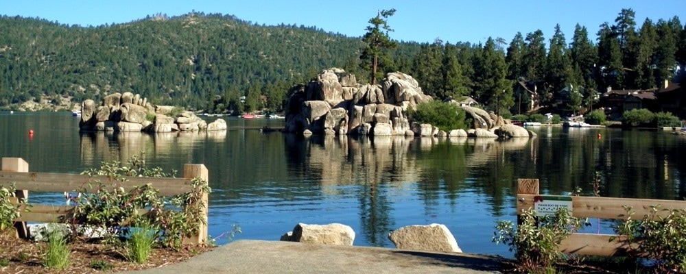
With a new lakeside park and high water level, Boulder Bay is the most iconic and scenic paddle launch spot right from the beach on Big Bear Lake (Free parking at Boulder Bay Park!). The calm protected waters are a great place to learn to paddle board, or if you are more adventurous, you can paddle NW to see the historic house on China Island or the Big Bear Dam. Click Here for a video guide of this location!
Call (909) 878-3155 to reserve your kayak or paddle board today!
Reserve Rentals Online
Call (909) 878-3155 to reserve your kayak or paddle board today!
Reserve Rentals Online
#2 Veterans Park
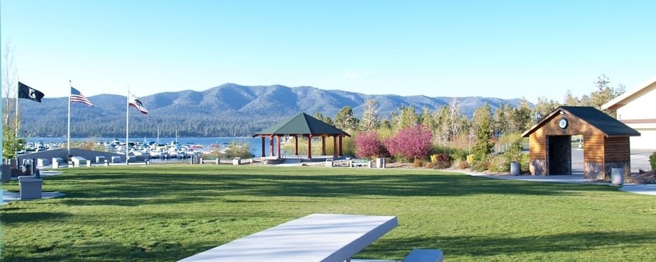
Launch right from our dock in Veterans Park at the corner of Knickerbocker Rd. & Big Bear Blvd.. Play on the sandy beach after you've explored the shoreline to explore between Gibralter Point and Eagle Point, and paddle up to the only lakeside restaurant & bar at B's Backyard BBQ and Boathouse near Pine Knot Marina. Click Here for a visual guide of this location!
Other fun Locations:
Untouched Shoreline - NE end of lake
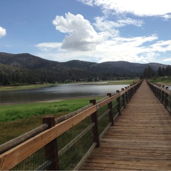
Stanfield Marsh Boardwalk
Explore the undeveloped shoreline along the Alpine Pedal Path area at the North East end of the lake. Launch from the beach near the Carol Morrison East Launch Ramp and paddle west along the North side of the lake to see people fishing, walking & riding bikes with spectacular mountain views to the South and Snow Summit Ski Resort!
Look for Mt. San Gorgonio at 11,500 feet this is the highest point in S. Cal. It sometimes has snow on top until late Summer!
TIP: It's best to paddle here in the early morning as winds and choppy water increase later in the afternoon.
Look for Mt. San Gorgonio at 11,500 feet this is the highest point in S. Cal. It sometimes has snow on top until late Summer!
TIP: It's best to paddle here in the early morning as winds and choppy water increase later in the afternoon.
Extreme Adventure - Circumnavigate the lake!

Averaging 1/2 mile across and 22 miles of shoreline, there's tons to see on Big Bear Lake. For an epic all-day paddle adventure you can paddle the whole shoreline! Bring food and water. Stop at Marinas for bathroom breaks and stretching, or pull up and find your adventure on any part of the shoreline.
If you explore all the bays and inlets and stay within a few hundred feet of shore you would paddle approx. 15.5 miles.
If you explore all the bays and inlets and stay within a few hundred feet of shore you would paddle approx. 15.5 miles.
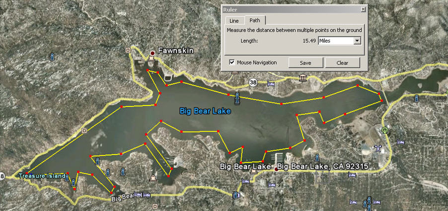
Paddle around Big Bear Lake - Google Earth Maps
